|
Quick Search
|
Search Results
You searched for: More Like: 'Dry Dock, Albert Basin'
30 items
items as
Albert Quay
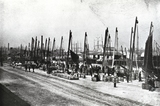
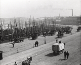
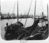
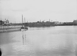
226 Looking north west along Albert Quay and Albert Basin.
Sailing smacks, traditional fishing boats, are moored along the quayside. This is before the days of steam trawlers. An array of barrels for the transport of fish can also be seen.
The masts of large sailing ships berthed in Victoria Dock can be seen in the distance. Albert Basin
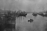
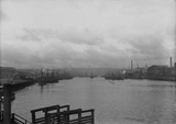
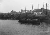
232 A photograph taken from Point Law looking west into Albert Basin.
In the foreground can be seen the harbour ferry with passengers onboard crossing from Provost Matthews' Quay, on the right, to the Ferry Office on Ferry Place, on the left of this image.
A steam paddle tug is towing a fishing boat in the background. Diversion of the River Dee
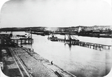
323 A photograph in Aberdeen Harbour looking east from the Inches (near the later site of Commercial Road).
The image looks across the old course of the River Dee including its spillwater channel towards Old Torry and Balnagask in the distance.
The civil engineering works shown in this photograph are thought to be part of the river diversion, creation of Albert Basin and the associated reclamation of land.
The diversion of the River Dee took place roughly between 1868 and 1873. Market Street and Commercial Road
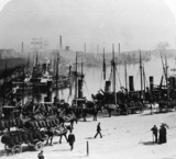
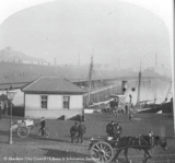
338 A photograph of Market Street at the upper part of Albert Basin. The covered fish market on Commercial Road is shown on the left.
This is prior to the fish market's extension along Market Street and Albert Quay.
See this photograph showing the lower part of the basin at the same time. Market Street and Albert Quay
339 A photograph of Aberdeen Harbour. The image likely dates from some time in the late 19th century.
The photograph was taken at the junction of Lower Market Street and Albert Quay, before the extension of the covered fishmarket along this stretch to the pontoon docks on the quay.
See this photograph taken slightly north showing the upper part of Albert Basin and the covered fish market then on Commercial Road. Dry Dock in Albert Basin
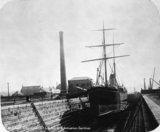
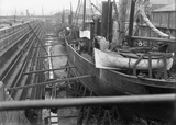
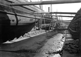
360 A large dry dock for the repair and overhauling of ships was opened at the eastern end of the Albert Basin in 1885. It was demolished in 1924-27 to make way for the covered fish market. The Dry Dock at Albert Basin
466 The Dry Dock for the repair and overhauling of steamships was opened at the eastern end of the Albert Basin in 1885. It was demolished in 1924-27 to make way for an extension of the covered fish market. Aberdeen Harbour with HMS Clyde
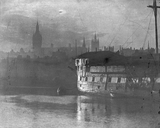
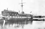
503 HMS Clyde at Aberdeen harbour. HMS Clyde was a man o' war with 46 guns and 1081 tons. The ship was for a long time moored in the Upper Dock where it served as a training ship. Connected to the quay by a floating gangway, the ship was open to visitors on Sunday mornings. After being shifted to Albert Quay it was towed away to be scrapped. The Harbour
1760 An image looking north towards the Tidal Harbour from the Balnagask side of the River Dee.
The image shows the main components of Aberdeen Harbour taking shape; the River Dee, Point Law, Albert Basin and Victoria Dock at the top. Albert Basin
1934 A George Washington Wilson photograph showing fishing boats in Albert Basin, Aberdeen Harbour. Market Street
1935 A photograph, looking east from Market Street, showing the covered Fish Market along Commercial Road.
This is image is from the turn of the 20th century, before the Fish Market was extended along Market Street and Albert Quay. The water shown is part of Albert Basin.
HMS Clyde
2098 HMS Clyde at Aberdeen harbour. HMS Clyde was a man o' war with 46 guns and 1081 tons. The ship was for a long time moored in the Upper Dock where it served as a training ship. Connected to the quay by a floating gangway, the ship was open to visitors on Sunday mornings. After being shifted to Albert Quay it was towed away to be scrapped. Aberdeen from Torry
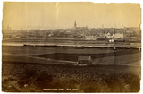
2671 A George Washington Wilson photograph of Aberdeen taken from across the River Dee in Torry.
Fishing boats are seen on the south side of the river. The spires of many Aberdeen landmarks are visible in the distance. The building on the far right of the image is the Castlehill Barracks. Aberdeen Fish Market
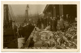
2707 An Adelphi Series postcard (no. 520) showing Icelandic fish being brought ashore and made available for sale at Aberdeen's covered fish market.
The covered fish market at Aberdeen Harbour was built in 1889 and was located on the north side of Albert Basin on Commercial Road, adjacent to Market Street.
This view likely looks west towards Market Street and Aberdeen more generally. The chimney visible in the background may belong to the Union Works then located beyond the Joint Railway Station. Albert Basin
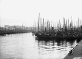
3334 A long shot looking west, towards Aberdeen, into Albert Basin with various trawler fishing boats.
Premises of A. & M. Smith, Ltd., preserved provision manufacturers on Albert Quay can be seen on the left of the image.
The steps and railings in the foreground are likely those of the terminal for the harbour ferry that went from the eastern end of Albert Quay, at Ferry Place, across the basin to Provost Matthews' Quay.
The spires of churches, including St. Nicholas Kirk, are visible on the skyline. Albert Basin
3335 A photograph looking south west showing Albert Basin.
Taken from Matthews' Quay, the premises of Meff Brothers, fish salesmen, are visible across the water on Albert Quay.
Berthed steam drifter fishing vessels registered in Aberdeen (A885), Buckie (BCK21 Eunice and Nellie) and Inverness (INS430 Scotsman, INS163 Thistle of Lossiemouth) can also be seen. Albert Quay
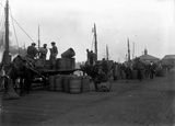
3337 A scene of industry at the end of Albert Quay.
Fishermen can be seen unloading crans of herring from their steam drifters into barrels on horse drawn carts.
Given the location, some way from the more hygienic fish market, and the rough and ready barrels, these may be condemned, waste fish, heading to nearby chemical works to be converted into fishmeal.
Looking east, the photograph shows the ferry office in the background on the right. Between the carts part of a pontoon dock marked Aberdeen can be seen in the distance.
The photograph was likely taken around the 1920s. Albert Quay
3338 Looking south east towards Albert Quay, not far beyond the extension of the fishmarket. The premises of Andrew Christie, fish curing works, on the corner of Clyde Street, can be seen in the background.
In the foreground bowler-hatted gentlemen are onboard a steam launch, with steam trawlers in the background (A112).
The many spectators on the quayside suggest a special occasion is taking place. Perhaps the relauch of a repaired boat. They stand over the No. 1 Albert Quay pontoon dock. Albert Quay
3339 A high shot looking north east over the Market Street end of Albert Quay and Albert Basin.
Train tracks can be seen heading to the quay's two pontoon docks. Steam trawlers are moored along the quay, including A137 Strathbran.
Across the basin can be seen the then end of the fishmarket on Commercial Road. By the mid-1920s it would be extended along to that quay's graving dock.
The photograph also dates from before the extension of the covered fishmarket along Market Street and the part of Albert Quay shown in the foreground here. Commercial Road
3513 Image taken looking west from the graving dock alongside Commercial Road illustrated in the Aberdeenshire LXXV.11 Ordnance Survey map published 1902.
This image depicts multiple steamships undergoing maintenance in the dry dock.
To the right of the image the lettering on the back of the Robert Millar & Sons, Ltd. building can be read, which confirms the location shown here.
Commercial Road and this graving dock were on the northern side of Albert Quay and to the south of these timber related businesses, which faced north on to Provost Blaikie's Quay and Victoria Dock. Commercial Road
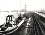
3514 Image looking east along the floor of the graving dock on Commercial Road. This dry dock is shown in the Aberdeenshire LXXV.11 Ordnance Survey 25-inch map published 1902.
The photograph depicts multiple steamships set up for maintenance. The third boat along is the Maggie Gault (INS 126). The Aberdeen Built Ships website states that the boat was built by John Duthie of Torry for James and William Gault, Lossiemouth. It was a steam herring drifter that launched in April 1910. Commercial Road
3517 A photograph, looking east, taken from the Market Street end of Commercial Road.
The image depicts moored steamships alongside the fish market on the north side of Albert Basin.
Boats can be seen moored all the along the quays of Albert Basin. This image likely dates from the early 20th century, prior to the extension of the covered fish market. Aberdeen Harbour
3526 A photograph looking across some part of Aberdeen Harbour towards a large number of berthed trawlers. The after decks of two boats are shown in the foreground.
The row of buildings on the skyline on the right may be the those on Market Street going north from Palmerston Road. If so, this would suggest the image looks south west to Albert Quay, across Albert Basin, from Commercial Road. Matthews' Quay
3534 Photograph taken looking north-east from Albert Quay into the Tidal Harbour, with Matthew's Quay visible on the left.
Photo depicts the Aberdeen Floating Dock which was located near and around Pocra Quay. This floating dock is mentioned in an April 24th, 1911 article from the Aberdeen Press & Journal where it states that it was built by Messrs Vickers, Ltd. in Barrow from their Naval Construction Works. The article was written while the floating dock was en route to Aberdeen which dates the photograph to some time after April 24th 1911.
Another article from the Aberdeen P&J from the 13th of July 1909 details how the construction of this floating dock cost the Harbour Commissioners of Aberdeen £49,250.
This floating dock was used for the maintenance, repair and painting of vessels within Aberdeen Harbour. It was commissioned and then later constructed for the purposes of servicing vessels which were too large for the existing stationary Graving Dock. |


