|
Quick Search
|
Search Results
You searched for: More Like: 'Brig o' Balgownie'
110 items
items as
Brig o' Balgownie
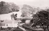
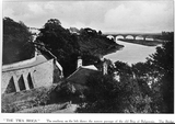
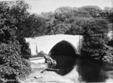
55 The Brig o' Balgownie over the River Don. Built by Richard Cementarius, the first Provost of Aberdeen 1314-1318. It was largely rebuilt at the beginning of the 17th century, repaired in the 19th century and the approaches widened and buttressed in 1912. Until 1827, the ancient bridge was the only route into Aberdeen from the North. Union Bridge
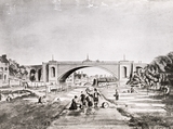
58 The Denburn looking southward towards and beyond Union Bridge, with the old Bow Brig in the distance and the houses adjacent. The Bow Brig featured largely in the social life of the inhabitants of the area. Note the bleaching green on the right of the print. Illustration taken from a plate drawn by Sir John Carr, 1807 Brig o' Balgownie over the River Don
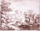
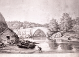
168 An engraving showing the Brig o' Balgownie over the River Don from a drawing by James Giles. The inscription in the bottom right indicates that the engraving was printed at the Deaf and Dumb Institution.
The title of this engraving describes the Brig o' Balgownie as the Bridge of Don. This is due to it serving as the main bridge over the river until the construction of the bridge known today as the Bridge of Don in 1827-30 by engineers John Smith and Thomas Telford.
This image likely looks south east along the river, towards the bridge, from between Tam's Hole and Black Nook. This was an important salmon fishing area in the past. Some information on the catching of fish on the river is given in the book The Annals of Aberdeen (Volume II, 1818) by William Kennedy, on pages 206-211. River Don, Aberdeen
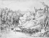
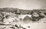
169 Near the Brig o' Balgownie over the River Don, Aberdeen. Caption reads: "Drawn by J. Giles, Aberdeen. Near the Bridge of Don. Printed at the Deaf & Dumb Institution" Brig o' Balgownie over the River Don
180 Brig o' Balgownie over the River Don. Caption reads, "The old Bridge of Don, or Balgownie's Brig. North of Aberdeen, one and a half miles" Torry Brickworks chimney
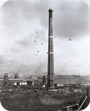
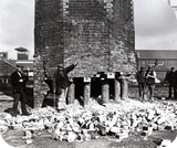
309 A photograph showing the largest of the three substantial chimneys stalks that were located at the brick and tile works in Torry, located between Sinclair Road and Victoria Road.
This is one of three photographs on the Silver City Vault taken during the demolition of this Torry landmark on Saturday 12th September 1903. A full account of the demolition can be read in the Aberdeen Daily Journal from 14/09/1903, page 6.
The report tells us that the hexagonal stalk was 175 feet in height, consisted of 155,00 bricks and weighed 500 tons. The demolition was overseen by Mr Peter Tawse, a well known contractor.
Two years previously in 1901, the Seaton Brick and Tile Company had relocated their works from the site in Torry to Balgownie.
Seaton Brick and Tile Company was formed in 1884 after taking over the Northern Patent Brick and Tile Co., which operated a works at Seaton Links. They moved to the Torry works shortly afterwards.
The company continued operation at Balgownie until going into voluntary liquidation on Friday 1st August 1924. This was reported, with a short history of the company, in the next day's Press & Journal (page 6). Demolition of Torry Brickworks chimney
310 A photograph of the demolition of the largest of the chimney stalks at the Torry brick and tile works that took place on Saturday 12th September 1903.
The photograph illustrates the method employed to fall the 175 foot structure, by the overseer Peter Tawse, as described in the Press & Journal:
"The preliminary work of cutting a gap in the chimney near the base was early accomplished by three of the skilled tunnellers employed by Mr Tawse at the Girdleness outfall sewer. As the gap widened, stout wooden props were put in to support the structure. The gap was carried to more than half the circumference of the chimney, and the sight of the weighty pile supported on one side by only a half-dozen wooden props was certainty sufficient to make one nervous. The gang was under the charge of a Lancashire foreman, and they worked away, pipe in mouth, quite unconcernedly.
"The gap having been completed, a charge of dynamite was inserted at the bottom of the props, and a time fuse attached to each.
"Excitement reached a high pitch among the spectators when the signal was given to fire the fuses, and the crowd began to edge further away when the smoke was seen curling round the props, and as the workmen bolted to get beyond the danger zone. First one charge and then the other exploded with a sharp report, but it was not until the props at the extreme ends of the half circles were blown to splinters, that the chimney showed any sign of moving. It then came down, as a spectator remarked, - 'Jist like a rum'le o' bricks.' It slid rather than fell straight down at first, but the top portion toppled over in a south-easternly direction, exactly on the line expected by the contractor. It was all over in a couple of seconds, and certainly it was a sensational sight - so quick, so clear, so safe."
P&J, 14/09/1903, page 6. New Quay
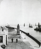
350 New Quay, Aberdeen Harbour. This photograph shows the navigation channel leading from Aberdeen Harbour into the North Sea, with the North Pier in the far distance on the left. The New Quay later became part of Pocra Quay.
The Pier was built by John Smeaton in 1781 and extended on several occasions to provide better access to the harbour. At the corner of the photograph is the customs Watch House, part of which has now been converted into a seafood restaurant.
The brick obilisk in the centre is a ventilation shaft for a sewer which emptied into the channel. A newer sewer outfall has rendered it redundant.
It is popularly known as Scarty's Monument. 'Scarty' was the nickname of William Smith, one of two harbour pilots in the mid-19th century. His duty was to keep watch from the North Pier during rough weather.
Nicknames were often used in the fishing community to distinguish between people of the same surname. The Linn o' Dee, c.1880
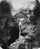
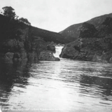
359 The Linn o'Dee is 65 miles west of Aberdeen and over 1200 feet above sea level. It is about a mile west of Inverey, the last settlement on Deeside and marks the end of the public road. The stone bridge which replaced a wooden structure was opened by Queen Victoria in September 1857. Salmon can often be seen here leaping upwards to their spawning grounds. The area is still a popular tourist attraction with views of the Cairngorms in the distance. Linn is a Scottish word for a rocky gorge with pools. Aberdeen Harbour
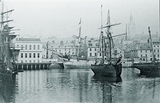
425 Aberdeen Harbour with sailing ships.
Correspondent Ed Fowler comments:
"The 2-Masted Brig Cheviot is moored in the centre of the Upper Dock and in the background on Trinity Quay stands the new Post Office (erected 1873-76 formerly the 2nd Fishmarket Site) opposite the added diagonal Quay Corner.
The adjacent Quayside Site has been demolished revealing the dilapidated Tenement Houses of lower Shiprow (No.s 78-84) bounded by Brebners Court & Sutherlands Court which were seldom previously Photographed. A temporary hoarding has been erected for the demolition works to the old Quayside Premises and a 3 Masted Square Rigged -Ship is Moored at the remainder of Trinity Quay ending at Shore Brae." Aberdeen Harbour with HMS Clyde
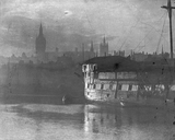
503 HMS Clyde at Aberdeen harbour. HMS Clyde was a man o' war with 46 guns and 1081 tons. The ship was for a long time moored in the Upper Dock where it served as a training ship. Connected to the quay by a floating gangway, the ship was open to visitors on Sunday mornings. After being shifted to Albert Quay it was towed away to be scrapped. Brig o' Balgownie
530 The Brig o' Balgownie over the River Don. Built by Richard Cementarius, the first Provost of Aberdeen between 1314-1318. It was largely rebuilt at the beginning of the 17th century, repaired in the 19th century and the approaches widened and buttressed in 1912. Until 1827, the ancient bridge was the only route into Aberdeen from the North. Castlegate looking west
674 Drawing of Castlegate looking west along Union Street.
Correspondent Ed Fowler got in touch to point out the salient features of "the Plainstones, Mercat Cross in is original position with the Athenaeum Reading Room, Tolbooth, the New Inn (Freemasons Lodge) and the Aberdeen Bank at the top of Marischal Street.
It is one of set of 3 drawings by the same artist employed by Gibb's the Lithographer. The others being the Brig o' Dee, and the Nether Kirk Gate, Benholm Lodging." Upper Denburn
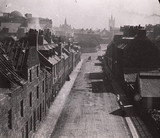
729 Upper Denburn, looking east, prior to its demolition.
Brick gable tenements can be seen on the left already stripped of their roofs.
The viewpoint is looking from the Dyers Court area eastwards towards Marischal College Tower and the retaining wall of the Royal Infirmary (with its dome on the skyline). This lead to Spa Street and Woolmanhill beyond.
The houses and tenements on the right are more sparse and primarily traders yards.
Garden Nook Close led off the left past a timber yard to the Well of Spa. The Well O' Spa Pub was on the extreme left corner.
Note the partial visible trade sign on the ridge of the distant roof - most likely James Stephen & Son. They were carvers, gilders/ornamental plasterers, mirror & picture frame makers, artists' colourmen and fine art dealers and operated at 48-50 Woolmanhill from around 1890-1933. Gordon's Hospital Spire rises beyond these premises.
(Many thanks to Ed Fowler for the above description). Brig o' Balgownie in winter
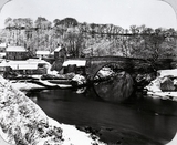
819 Brig o' Balgownie in the wintertime around 1880. Prior to the construction of the new Bridge of Don in the 1820s the Brig o' Balgownie was the only access road from Aberdeen to the north. Boys' Brigade King's Message
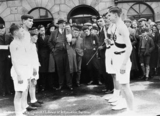
1010 A photograph showing the Boys' Brigade King's Message at Stonehaven Market on 23rd April 1935. The town's 1827 Market Buildings can be seen in the background.
To mark the silver jubilee of King George V on 6th May 1935 the Boys' Brigade undertook a roughly 2300 mile relay run of a silver baton containing a message of homage and congratulation from John O' Groats to London.
The journey started in stormy weather at 7am on 16th April 1935. As the baton travelled south it was passed from runners from one Brigade company to another.
The leg from Culter to Maryculter was carried by Sgt. W. Duthie, Cpl. D. Birse and Pte. D. Angus. The baton was then transferred to Sgt. H. Douglas, Pte. W. Brooks and Pte. L. Gordon for the next leg to Netherley and the leg to Stonehaven was carried by Sgt. J. Brown, Pte. A. Brown and Pte. I. Hay.
This photo likely shows the latter three runners having handed on the baton for the next leg. An account of this part of the baton's journey can be found in the Press & Journal of 24th April 1935 on page 5. The article indicates the baton left Culter at 7.45am on 23rd April 1935 and reached Stonehaven at 11am the same day.
The next stage south, to Kinneff, was undertaken by Sergeant J. Thomson, escorted by Corporal Christie and Lance-Corporal G. Thomson, all of 21st Aberdeen company. Central School (Aberdeen Academy)
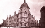
1458 In 1901, Aberdeen School Board planned to build a new central higher grade school and plans were drawn up by John A. O. Allan for a building on the corner of Schoolhill and Belmont Street. The new school was opened in November 1905. It planned to cater for pupils aged 12 - 15 years coming from all the town's elementary schools, with over 1,000 on the roll initially. In 1954, the school changed name to become Aberdeen Academy, and its intake comprised those pupils who successfully passed their 11+ exams in Primary 7. The school closed in 1969 and the pupils moved to the newly built Hazlehead Academy. The building became a Resources centre for the Department of Education and then in the late 1990s became a shopping centre named "The Academy". St. Machar's Cathedral
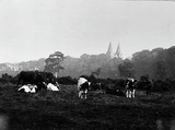
1841 St. Machar's Cathedral, Old Aberdeen, showing a field with cows in the foreground. This image looks south east towards the church and may have been taken from the field west of Kettock's Mills and south of Balgownie Lodge.
The photograph likely dates from early 20th century and Aberdeen City Libraries hold a glass lantern slide version in our George Kemp collection. Corbie Well
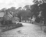
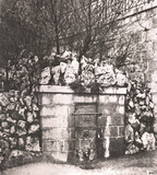
1855 The Corbie Well, deriving its title from the fact that a large rookery colony existed among the trees that covered the bank of the Denburn Valley, near where the well stood. The wall and fence seen above the well are the gardens of Denburn Terrace. The Corbie Well was rebuilt in a different form when the Union Terrace Gardens were laid out in 1877.
Correspondent Ed Fowler provides more information on the later history of the well:
"The older well was replaced in 1898 by an outlet in a plain granite ashlar wall. An inscription - 'Renewed 1856' - from the old well was removed during later modernisation, and until the 1960s the wall supported one of the stone pillar lamp-posts from the 1747 Bow Brig surmounted by the weather-vane from the steeple of old St Nicholas Kirk." |


