|
Quick Search
|
Search Results
You searched for: "Help us to index more images" Online Exhibitions contains these items
65 items
items as
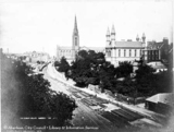
The Denburn
1466 View of the Denburn looking north from Union Bridge on Union Street. Union Terrace Gardens are to left of photograph. Railway lines in image leads to Inverness.
(Derek Walker, Aberdeen) 1467 This image has not yet been indexed. Use the Comments button below the image to enter information about the photograph.
Please note: we will not include any personal information provided unless you indicate that you wish to be acknowledged. The standard form for crediting your information is (name, place) e.g. (John Smith, Aberdeen). 1468 This image has not yet been indexed. Use the Comments button below the image to enter information about the photograph.
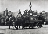
Please note: we will not include any personal information provided unless you indicate that you wish to be acknowledged. The standard form for crediting your information is (name, place) e.g. (John Smith, Aberdeen). The Cluny Bus at Queens Cross.
1469 Correspondent Dr Mike Mitchell has been in touch to tell us that the horse drawn bus in this photograph is one of "Allan's Liners". This was the name given to the Aberdeen to Cluny bus from its introduction in 1849 until the route passed to the Great North of Scotland Railway motor buses in 1906. Allan continued to run mail gigs and coaches until at least after the Great War.
(Many thanks for this information.) St. Paul's Street School
1470 This image has not yet been indexed. Use the Comments button below the image to enter information about the photograph.
Please note: we will not include any personal information provided unless you indicate that you wish to be acknowledged. The standard form for crediting your information is (name, place) e.g. (John Smith, Aberdeen). St. Paul's Street School
1471 This image has not yet been indexed. Use the comments button below the image to enter information about the photograph.
Please note: we will not include any personal information provided unless you indicate that you wish to be acknowledged. The standard form for crediting your information is (name, place) e.g. (John Smith, Aberdeen). Westerton of Auchmill Farm
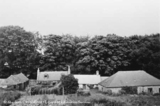
1472 This photograph, likely by James G. Kellas and taken in around 1951, looks north west towards the farm of Westerton of Auchmill.
Its buildings are located just north east of the Northfield housing estate and remain at this location as of 2020. They are now largely bordered by Auchmill Golf Course, which also covers the previously nearby Dancing Cairns Quarry.
While the farm buildings still exist, this lane, which in the opposite direction would have lead to Westerton/Midtown Farm, has been replaced by the housing around Bonnyview Drive. 1473 This image has not yet been indexed. Use the Comments button below the image to enter information about the photograph.
Please note: we will not include any personal information provided unless you indicate that you wish to be acknowledged. The standard form for crediting your infomation is (name, place) e.g. (John Smith, Aberdeen) Westerton Farm
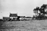
1474 A photograph, likely by James G. Kellas and from around 1951, showing one of either two farms known as Westerton. Both have since been demolished.
It could be the Westerton Farm that was located on the old road that preceded Provost Fraser Drive. Near where Provost Fraser Drive now meets Springhill Road, in the space between Provost Fraser and Springhill Terrace.
This Westerton Farm was demolished shortly after this photograph was taken to make way for the development of the Northfield housing estate.
Across the old road from this farm was the lands of Springhill House and Farm.
The other Westerton Farm was just to the north east of Northfield Farm and a bit south of Dancing Cairns Quarry. This farm was also previously known as Midtown.
Like Northfield Farm (demolished late 50s/early 60s), this Westerton survived the initial development of Northfield as a housing estate. Ordnance Survey maps suggest the farm made way for the construction of Marchburn Court, and the extension of Smithyhaugh Road, in the mid-to-late 1960s.
It is difficult to say for certain which farm this photograph shows. The hills in the background perhaps suggest we are looking west towards the more northernly Westerton, the one nearer Northfield Farm. West Summerfield Farm
1475 This image has not yet been indexed. Use the Comments button below the image to enter information about the photograph.
Please note: we will not include any personal information provided unless you indicate that you wish to be acknowledged. The standard form for crediting your information is (name, place) e.g. (John Smith, Aberdeen). Springhill Farm
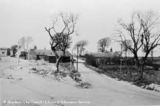
1476 A photograph of Springhill Farm. Looking north up Springhill Road. The building on the left can still been seen in 2017. The land around the farm and Springhill estate has been radically altered over the years. It is now flat parkland.
This photograph was likely taken by James G. Kellas in around 1951. Springfield Cottage
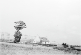
1477 Springfield Cottage as seen from Springfield Road looking north west. The photograph was likely taken during the 1950s at which point the cottage was on the outskirts of the city.
The residential development we know as Craigiebuckler had yet to be built. The line of trees in the background is that of Craigiebuckler Avenue. If we turned the camera some degrees to the north we would have a view of Craigiebuckler Parish Church and its halls.
The cottage was most likely demolished as part of the aforementioned residential development.
(Many thanks to A. G. Duthie for information on the location of this cottage). Westerton and Caiesdykes Farm
1478 This image has not yet been indexed. Use the Comments button below the image to enter information about the photograph.
Please note: we will not include any personal information provided unless you indicate that you wish to be acknowledged. The standard form for crediting your information is (name, place) e.g. (John Smith, Aberdeen). Willowpark Croft farm
1479 This image has not yet been indexed. Use the Comments button below the image to enter information about the photograph.
Please note: we will not include any personal information provided unless you indicate that you wish to be acknowledged. The standard form for crediting your information is (name, place) e.g. (John Smith, Aberdeen). Raeden Farm
1480 This image has not yet been indexed. Use the Comments button below the image to enter information about the photograph.
Please note: we will not include any personal information provided unless you indicate that you wish to be acknowledged. The standard form for crediting your information is (name, place) e.g. (John Smith, Aberdeen). Old Town Farm
1481 This image has not yet been indexed. Use the Comments button below the image to enter information about the photograph.
Please note: we will not include any personal information provided unless you indicate that you wish to be acknowledged. The standard form for crediting your information is (name, place) e.g. (John Smith, Aberdeen). Silverhillock Farm
1482 An image looking north east showing Silverhillock Farm in the 1950s.
The property, through which flowed the Gilcomston Burn, was located at the junction of Westburn Road and Foresterhill Road.
The Royal Infirmary buildings can be seen in the background. Mains of Ruthrieston
1483 This photograph by James Kellas from the early 1950s shows a farm called Mains of Ruthrieston. It was located where Cranford Road joins Broomhill Road. This image looks north east from Cranford Road.
(Thanks to A. G. Duthie for identifying this location). Denhead Farm, Rubislaw
1484 This photograph by James Kellas from the early 1950s shows Denhead Farm in the area of Rubislaw. It was located on the south side of Carnegie Crescent, north of the western part of Rubislaw Den.
Local historian A. G. Duthie has been in touch to tell us that the Duncan family, who were tenants there, ran the farm as one of many market gardens in the Rubislaw Den area. It was a working farm until the later 1950s when it was demolished as part of residential development. Rosehill Farm
1485 A photograph, likely by James G. Kellas and from the early 1950s, showing Rosehill Hill Farm.
The large scale Ordnance Survey map surveyed in 1867, those revised in 1899 and in 1924 show the farm located on the north side of Cairncry Road. Rosehill Quarries were located to the north of the farm buildings.
The OS map surveyed in 1955 shows the farm surrounded by a modern housing estate. The buildings are then nos. 8, 10 and 12 Blackthorn Crescent.
The farm buildings later appear to have made way for new housing developments on Blackthorn Crescent and no remains of the farm can be seen today.
In the early 19th century the lands of Rosehill, along with Burnside and Ruthrieston, were acquired by Alexander Duthie, a successful advocate in Aberdeen, and later passed to his grandson Walter, a writer to the signet in Edinburgh. Walter was the uncle of Elizabeth Crombie Duthie, who donated Duthie Park to the people. See the latter's obituary in the Evening Express of 30th March 1885, page 3, for further detail. Raeden Home Farm
1486 This image has not yet been indexed. Use the Comments button below the image to enter information about the photograph.
Please note: we will not include any personal information provided unless you indicate that you wish to be acknowledged. The standard form for crediting your information is (name, place) e.g. (John Smith, Aberdeen). Bannermill from Broad Hill
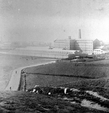
1487 A photograph looking south west from Broad Hill towards the Bannermill (or Banner Mill) cotton works.
The road in the foreground is that which would become Links Road. This continued along the north side of the factory and had a junction with Constitution Street at the north east corner of the works. The land shown in front of Bannermill is Queen's Links.
The location of Bannermill is now occupied by a large square shaped complex of mostly early 21st century flats (completed 2004), with parking in its middle, and a main entrance, on Bannermill Place, accessed from Constitution Street.
The factory was established in 1827 by Thomas Bannerman and closed down in 1904, then under the management of Messers Robinson, Crum & Co. Limited.
The premises were used as stores and for various types of works during the 20th century.
In 1999 the 5.8 acres site was put on the market by the then owners, the North Eastern Farmers (NEF) co-operative, with a price of around £5million. NEF left the site in February 1999 to move to a new headquarters at Rosehall, Turriff. (See P&J, 11 November 1999, p. 7)
Aberdeen City Council subsequently produced a planning brief for developers calling for a housing or mixed housing and hotel development on the site.
Wimpey House submitted a plan for 349 luxury flats and this proposal was given the go-ahead. Construction primarily took place during 2002 and 2003, with the first residents moving-in in October 2002. 1488 This image has not yet been indexed. Use the Comments button below the image to enter information about the photograph.
Please note: we will not include any personal information provided unless you indicate that you wish to be acknowledged. The standard form for crediting your information is (name, place) e.g. (John Smith, Aberdeen). Craigton Road Steading
1489 This image has not yet been indexed. Use the Comments button below the image to enter information about the photograph.
Please note: we will not include any personal information provided unless you indicate that you wish to be acknowledged. The standard form for crediting your information is (name, place) e.g. (John Smith, Aberdeen). |


