|
Quick Search
|
Home
> Show All
507 items
items as
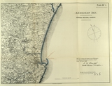
Aberdeen Bay, Proposed National Harbour, Plan No.1
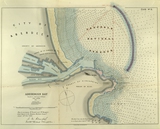
2 Supplementary Plan No.1 to accompany Mr Rendel's and Mr. Kinipple's Joint Report to the Aberdeen Harbour Commissioners, dated 28th November 1883. Aberdeen Bay, Proposed National Harbour, Plan No.2
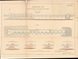
3 Supplementary Plan No.2 to accompany Mr Rendel's and Mr. Kinipple's Joint Report to the Aberdeen Harbour Commissioners, dated 28th November 1883. Aberdeen Bay, Proposed National Harbour, Plan No.3
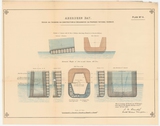
4 Supplementary Plan No.3 to accompany Mr Rendel's and Mr. Kinipple's Joint Report to the Aberdeen Harbour Commissioners, dated 28th November 1883. Aberdeen Bay, Proposed National Harbour, Plan No.4
5 Supplementary Plan No.4 to accompany Mr Rendel's and Mr. Kinipple's Joint Report to the Aberdeen Harbour Commissioners, dated 28th November 1883. Aberdeen Savings Bank, Union Terrace
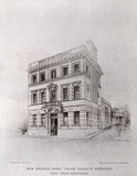
8 Engraving of the New Aberdeen Savings Bank, Union Terrace. Designed by William Kelly, 1896. Thomson and Duncan, collo-type, Aberdeen W. and J. Smith and Kelly, architects The Castlegate
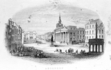
10 Engraving of the Castlegate, c. 1850. The statue of the last Duke of Gordon, erected in 1844, was removed in the 1950s to Golden Square. Published by G. Shepherd, Broad Street, Aberdeen Broad Street looking South
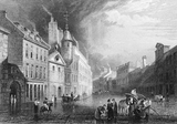
11 Busy scene in Broad Street in 1833, showing buildings on the left hand side which were demolished for the extension and frontage of Marischal College. The archway at the left led through to the original buildings of Marischal College and the original Greyfriars Church. The Water House, surmounted with a pediment and clock, was erected in 1766 as a reservoir for the town's water supply. The clock and its bell were transferred to the City Hospital in 1899. Byron lived with his mother in the tenement block next to the turreted building. On the west side of the street, the tall building in the distance was the first office of the North of Scotland Bank. Broad Street, Aberdeen
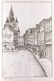
12 Drawing of Broad Street, at junction with Queen Street, looking towards Union Street. Spire of the Town House at the left of the image. Northfield Mission Church
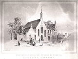
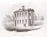
13 Engraving of Northfield Mission Church and School, Gilcomston. Drawing by Andrew Gibb.
Popularly known as 'Laing's Kirkie', Northfield Mission Kirk was opened in Leadside Road on 10 November 1850. The building was designed and funded mainly by Alexander Laing, coachbuilder, as part of the Free Church Mission in the Northfield area of Gilcomston. At that time the area had a bad reputation and poor housing conditions. In 1863, Mr Laing handed over the chapel to the charge of the Free East Church, and the school was transferred to the School Board. Although the new Rutherford Church opened in 1870, the Mission Kirk continued its work. Christ's College, Alford Place
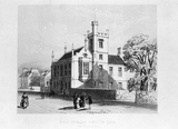
14 Engraving of Christ's College, Alford Place. Designed by Thomas Mackenzie 1850. It was a building to train ministers for the Free Church. Later occupied by "The College" bar (2007). Girdleness Lighthouse
15 Engraving of Girdleness Lighthouse, 1840. The lighthouse was built by Robert Stevenson in 1833. View of Aberdeen from Torry
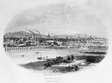
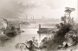
16 View of the city from Torry, 1850, showing the railway viaduct and the city skyline. Drawn and engraved by W. Banks and Son, Edinburgh
Union Bridge
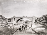
17 The Denburn looking southward towards and beyond Union Bridge, with the old Bow Brig in the distance and the houses adjacent. The Bow Brig featured largely in the social life of the inhabitants of the area. Note the bleaching green on the right of the print. Illustration taken from a plate drawn by Sir John Carr, 1807 Bridge of Dee
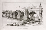
18 The Old Bridge of Dee dating from the early 14th century was begun by Bishop William Elphinstone c.1493. Further building started in 1518 and was carried out by Alexander Galloway and Thomas Franche. In 1840, the bridge was widened by John Smith, the City Architect. Drawing by Curtis Green. Lithograph by Gibb & Hay. The Wellington Suspension Bridge
19 The Wellington Suspension Bridge over the River Dee was built in 1829 by Samuel Brown and John Smith. It connects Ferryhill with the high bank of Craiglug to the south. Print dated 1850. The bridge, locally known as the 'Chain Bridge', was closed to traffic and pedestrians because of its poor condition before reopening after restoration in 2008. Upperkirkgate
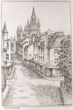
20 Upperkirkgate, showing Marischal College's towers and spires. Drawing by D. R. Alexander. Provost Skene's House
21 Provost Skene's House, dating from 1545, also known as Cumberland's Lodging when it was occupied by the Duke of Cumberland during his pursuit of Jacobites in 1746. It belonged to Sir George Skene of Rubislaw, Provost of Aberdeen from 1676 to 1685. In the nineteenth century, it had become the Victoria Lodging House and was only saved from demolition in 1938 by the intervention of the Queen Mother. It is now used as a museum. Castlehill Barracks
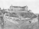
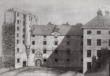
22 A view of the southern aspect of the Castlehill in about 1850, with the Barracks featuring prominently. The Barracks replaced the Chapel of St. Ninian and an observatory erected in 1781. The foundation stone was laid on 24th June 1794 by the Marquis of Huntly and it was completed early in 1796, with accommodation for 600 men. The picture is interesting, as it shows the line of Hangman's Brae, which descended from the south west corner of the hill to Castle Lane and into Virginia Street. It was partly absorbed into the construction of Castle Terrace in 1864. The houses on the left of the illustration with the outside steps were incorporated into the first Hospital for Sick Children in 1877. Bon Accord Crescent
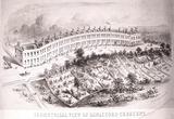
23 Isometrical view of Bon Accord Crescent - This perspective drawing shows the gently curving terrace of 19 identical two-storey houses, with basement and attic, designed by Archibald Simpson in the 1820s for the Corporation of Tailors. In 1823, the "Aberdeen Journal" carried an advertisement for building areas to feu. The houses were to be laid out on what had previously been garden ground and the advert boasts "No situation, immediately in the vicinity of Aberdeen, possesses so completely the advantages of free air and fine exposure". The properties overlook the hollow once occupied by the Howe Burn and the area has now been converted into landscaped parkland as part of a conservation area. Houses 3-17 have a curved frontage, while numbers 1 and 2, and 18 and 19 have straight frontages. However, even by the 1950s, most of the houses were being, and still are, used as offices.
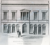
Mechanic's Institute
24 Aberdeen's first public Lending Library opened in the building of the Mechanic's Institute, Market Street on 12 March 1886.
Designed in 1845 by Archibald Simpson (with William Ramage), the Institute was initially a place of entertainment but subsequently became a public library on the adoption of the Public Libraries Act (1884).
Unfortunately, the building soon proved to be inadequate and in 1889 an Appeal Fund for a new Central Library was launched. This building later became the Bon-Accord Hotel. Gordon's Hospital
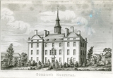
25 Gordon's Hospital from 1731, designed by William Adam, was a school for the education of orphaned boys, endowed by Robert Gordon. His statue, by John Cheere, is seen above the doorway. Although completed by 1739, it was not occupied by pupils until 1750. John Smith remodelled and extended the building in 1833. It became Robert Gordon's College in the 1880s. Wallace Tower, Netherkirkgate
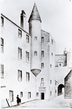
26 Wallace Tower in the Netherkirkgate looking towards St Nicholas Church. The tower never had any connection with William Wallace. It is believed to have been the town residence of Sir Robert Keith of Benholm. The name "Wallace" may have been a corruption of "well-house". The Wallace Tower was re-sited at Tillydrone in the 1960s. Marischal College
27 Marischal College, University of Aberdeen, on Broad Street. These buildings were replaced by those designed by Archibald Simpson in the 1840's.
|


