|
Quick Search
|
Search Results
You searched for: More Like: 'Flourmill Brae'
68 items
items as
Hardweird
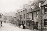
40 The Hardweird. Part of old Gilcomston, it resembled a small "ferm toon" standing between the foot of Jack's Brae and Upper Denburn and it consisted of 18th and early 19th century artisan and labourers' housing - a product of the period when Gilcomston had a flourishing weaving industry. One of Aberdeen's worst slums, it was cleared during the early 1930s and the playground of Gilcomstoun Primary School now occupies part of the site. Castlehill Barracks
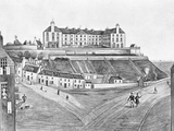
106 A view of the southern aspect of the Castlehill in about 1850, with the Barracks featuring prominently. The Barracks replaced the Chapel of St. Ninian and an observatory erected in 1781. The foundation stone was laid on 24th June 1794 by the Marquis of Huntly and it was completed early in 1796, with accommodation for 600 men. The picture is interesting, as it shows the line of Hangman's Brae, which descended from the south west corner of the hill to Castle Lane and into Virginia Street. It was partly absorbed into the construction of Castle Terrace in 1864. The houses on the left of the illustration with the outside steps were incorporated into the first Hospital for Sick Children in 1877. Union Bridge from Windmill Brae
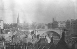
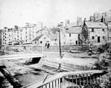
123 This photograph by George Washington Wilson, looking towards Union Bridge, shows the old red-tiled roofed houses in the Windmill Brae area in the 1850s. Most of these were swept away with the construction of the railway and the building of Bridge Street around 1865-1867.
The house at the left, on the corner of Union Terrace, was owned by Harry Lumsden of Belhelvie and later by the Northern Club. Its site became part of that occupied by the Northern Assurance Company offices.
The spire of the Triple Kirks and the tower of the South Parish Church are visible in the background. The Hardweird
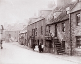
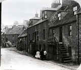
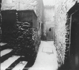
126 The street known as the Hardweird, so named as having been built on the Hardweird Croft. The last street in Aberdeen to show the 'forestairs' that were so common in the older streets of the town. Some of the houses were demolished in 1908. The Hardweird ran from Skene Row to Jack's Brae. Skene Row came off Skene Street, opposite Chapel Street.
This photograph looks east and is likely taken not far from the junction of Hardweird and Upper Denburn. These dwellings are those that stood on the south side of Hardweird. The land was later developed as utility type facilities with Skene Street School playing field above. Granite yard
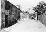
146 Local historian A. G. Duthie has been in touch to suggest that this photograph most likely shows a granite yard. Slabs of the rock can be seen by the wooden fence and the men are standing near small sheerleg cranes.
Brian Kennedy has also contact us to identify the location of the image. It is looking north west along the thoroughfare that is identified as Duthie's Brae on early Ordnance Survey maps. The tenements in the background are those on Nellfield Place. The smaller house on the left in the background was known as Home Cottage and was one of the first built on the street that was then called Holburn Place.
Maps indicate the buildings shown on the left were used as malt barns and later as storehouses. Duthie's Brae was just south of where Hardgate met Fonthill Terrace.
This photograph was likely taken by James Ritchie in 1917. There is another image on this website by Ritchie that looks south from a nearby position. Aberdeen Harbour
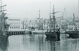
425 Aberdeen Harbour with sailing ships.
Correspondent Ed Fowler comments:
"The 2-Masted Brig Cheviot is moored in the centre of the Upper Dock and in the background on Trinity Quay stands the new Post Office (erected 1873-76 formerly the 2nd Fishmarket Site) opposite the added diagonal Quay Corner.
The adjacent Quayside Site has been demolished revealing the dilapidated Tenement Houses of lower Shiprow (No.s 78-84) bounded by Brebners Court & Sutherlands Court which were seldom previously Photographed. A temporary hoarding has been erected for the demolition works to the old Quayside Premises and a 3 Masted Square Rigged -Ship is Moored at the remainder of Trinity Quay ending at Shore Brae." St. Nicholas Street
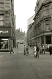
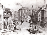
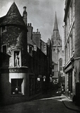
436 St. Nicholas Street looking up Flourmill Brae. The Equitable Building is on the right. These buildings were demolished in 1985 to make for for the St. Nicholas Centre. Provost Skene House and St. Nicholas House are visible at the top of the road. Denburn
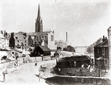
493 The Denburn Valley and Mutton Brae prior to the construction of Rosemount Viaduct. The Triple Kirks are visible in the middle of the image and Union Bridge can seen in the background. The Puffing Briggie
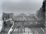
532 A scene of change and renovation in the Denburn Valley. The image looks south from Union Bridge over the suburban platforms of the old Aberdeen Joint Railway Station. The old station's large, curved roof can be seen in the background.
The area we are looking at has seen much change since this time. It is now largely covered by the 1960s retail development on the south side of the bridge, the later Trinity Centre, the development of Wapping Street and Denburn Road, and the building of Atholl House. Though many of the buildings of note we can see in this image are still visible today.
The tall buildings on the far right are the rear of those on Bridge Street. The small street in front of them, going up to Guild Street, is the start of College Street. It is now a partially pedestrianised lane that goes under Wapping Street. The building at the top of this street is the classical style suburban ticket office, built 1909 and now home to Tiffany Hair & Beauty.
Going west along Guild Street's two span road bridge we come to the Great North of Scotland Railway Company's headquarters. This was designed by architects Ellis & Wilson and built in 1894. It is now part of the Station Hotel, along with number 78 next door. The building retains many of its original features. The Guild Street entrance to the Trinity Centre now runs along the western side of this building.
The image also shows features that are no longer present. The covered walkway that can be seen on the near right of the image enabled direct access from the station's central platform to the Palace Hotel on Union Street. The hotel was owned by the Great North of Scotland Railway Co. (GNSR). The walkway was vaulted to pass over the tracks at sufficient height.
Consulting The Joint Station: Aberdeen Station, 1867-1992 (c1992), this image probably dates from 1912 when, in additional to commencing the reconstruction of the Joint Station, the GNSR also laid new loading docks and carriage storage siding in the Hadden Mills site (left of image). This was to ensure that the main station buildings were used purely for passenger traffic.
The walkway that linked Windmill Brae and the Green, known affectionately as the Puffing Briggie, can be seen in the centre of the image. It looks like a section on the left has been temporarily demolished as part of the ongoing work.
The sidings on the extreme left were used for cleaning carriages in the later 20th century. One of our correspondents recounts using the often-unattended carriages, accessible when entering the station from the Green, as an unusually exciting and plush playground during their youth in the late-1940s. Jack's Brae
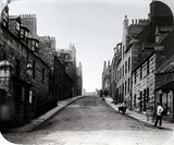
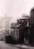
710 A photograph looking north west up Jack's Brae, from its junction with Upper Denburn, in the Rosemount area. Jack's Brae was named after the owner of property there. This photograph likely dates from the mid-to-late 19th century.
The Ordnance Survey town plan of Aberdeen, 1:500 scale, surveyed in 1866-67 depicts a "Coffee Roasting and Grinding Works" at the top of Jack's Brae at its junction with Leadside Road. A large chimney of these works can be seen on the right side of this image in the distance.
These works were the premises of John Strachan. In the Aberdeen Post Office Directory for 1867-68, Strachan is described as follows:
"Strachan, John, coffee roaster, coffee, sugar, and sugar grinder, Jack's brae" (page 213).
Aberdeen City Council's Historic Environment Record describes the site thusly:
"Site of meal mills, built in the 18th - 19th Centuries and demolished in the 1980s. The works was two-storey with a basement, comprising a 9-bay range with a single kiln and a three-storey with attic 5 by 6-bay block of later date. There were also two 2-storey store blocks. The mill was originally water powered, later electrically driven. The OS 1st edition map depicts a coffee roasting and grinding works here; they are annotated as corn mills on the OS 25in map published 1924." (link here).
The business was known as John Strachan & Sons and the works as Gilcomston Mill. The business was started in around 1852 and John Strachan was succeeded as its proprietor by his son James Strachan (1838-1914). His obituary can be found in the Evening Express of 28th December 1914, page 5. His son, John Strachan, was later to become the business's managing director. The obituary of this later John Strachan can be found in the Press & Journal of 1st July 1935, page 8.
At the time of writing in 2022, the site is occupied by a residential complex called Strachan Mill Court - no doubt named after the coffee roasting and milling enterprise. Hardweird
718 The Hardweird, so named as having been built on the Hardweird Croft, is now the only street in Aberdeen showing the 'forestairs' that were so common in the older streets of the town. The Hardweird ran from Skene Row to Jack's Brae. Skene Row came off Skene Street, opposite Chapel Street. Part of old Gilcomston, it resembled a small "ferm toon" standing between the foot of Jack's Brae and Upper Denburn and it consisted of 18th and early 19th century artisan and labourers' housing - a product of the period when Gilcomston had a flourishing weaving industry. Some of the houses were demolished in 1908. One of Aberdeen's worst slums, it was cleared during the early 1930s and the playground of Gilcoumston Primary School now occupies part of the site. Marischal Street
732 This photograph shows Marischal Street at its junction with Regent Quay, looking north towards Castle Street.
It was built to improve the connection between the harbour and the main part of the city, which had previously only been accessible via the steep incline of Shore Brae and the Shiprow.
In 1766, the Town Council were successful in purchasing the unoccupied Lodging of the Earl Marischal of Scotland which stood on the south side of the Castlegate. It was then demolished to open up the way for the new street, named in the Earl's honour.
It was the first street in Aberdeen to be paved with dressed granite setts. Houses were built and were occupied by prosperous professional men such as Dr William Dyce; Andrew Roberston, William Young and Alexander Fraser; both to become Provosts of Aberdeen. These properties were mostly converted to commercial use in later years.
The buildings on the right were replaced by the long and narrow, neo-classical building, designed by Robert Gordon Wilson and built in 1901-02, that can still be seen today at 33 Regent Quay. Jack's Brae and March Lane
773 A photograph looking south east down Jack's Brae, past March Lane, towards upper Denburn in 1927.
The Ordnance Survey town plan from 1866-67 indicates that the buildings at the foot of Jack's Brae, beyond March Lane, and shown in the centre here, had a tannery to their rear. All these buildings on Jack's Brae were demolished and the land is now a green space.
The substantial granite building in the background on the left is Skene Street School, later known as Gilcomstoum Primary School. The wall that can be seen at the junction of Upper Denburn remains at the time of writing in 2022.
A city royalty boundary stone, marked "CR" can be seen underneath the March Lane street sign. Wallace Tower
884 To the left can be seen the Wallace Tower, formerly known as Benholm's Lodging, in its original location at the junction of the Netherkirkgate and Carnegie's Brae. The Wallace Tower was a 15th century fortified house, the residence of Sir Robert Keith of Benholm. For a large part of its life in the 20th. century, it functioned as a public house before being re-sited at Seaton Park, Tillydrone, in 1963. In the centre can be seen the clock tower of St. Nicholas Kirk. Milltimber Brae culvert washed out by flood
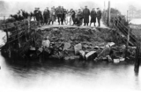
1025 Culvert washed out by flood, Milltimber Brae, August 1923. MacPherson outing
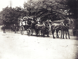
1036 This image taken in 1902 shows a horsedrawn coach full of people ready to go on an outing. It had been organised by James MacPherson, joiner in Cults and the photo is taken at the east side of Kirk Brae. Such outings were commonplace at this period when firms organised day trips into the country for their employees. Cults Free Church on Kirk Brae
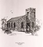
1037 Cults Free Church on Kirk Brae. The foundation stone was laid by Mr Shirra Gibb on 4th September 1843, and the church was opened in 1844. The sketch is dated July 1956. Wallace Tower
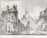
1275 Wallace Tower, Netherkirkgate (also known as Benholm's Lodging and Keith's Lodging) . In the background is the old East Church of St Nicholas, whose spire was destroyed by a fire on 9th October 1874 and rebuilt in 1876. Carnegie's Brae is at the left of the photograph. The building is now re-sited at Tillydrone. Upper Denburn and Hardweird
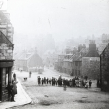
1515 This photo was taken from the bottom of Jack's Brae, looking eastwards. The road in middle of the photo is the Hardweird and the road to the left of the V-junction is Upper Denburn. (Brian Kennedy, Aberdeen)
The partially visible tenements on the skyline in he centre of this image are those at the junction of Skene Street and Rosemount Viaduct. Mutton Brae and Lower Denburn
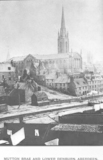
1668 Mutton Brae and Lower Denburn, Aberdeen. Mutton Brae ran from Schoolhill to Lower Denburn. Many of the houses there were occupied by handloom weavers who worked in a large cotton factory at the corner of Belmont Street and Schoolhill. The missionary Mary Slessor lived here. After the factory closed in 1830, the buildings were demolished and the site was developed for the three Free Churches, designed by Archibald Simpson, which opened in 1843/44. These are now referred to as the Triple Kirks. Many of the other houses were demolished to allow the building of the Denburn Valley Junction Railway which opened in 1867.
Brae Farm
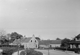
1790 This photograph was taken in 1951 by James Kellas and looks east showing, on the left, the rear of Brae Farm, located on Morningside Road, and part of 142 Morningside Avenue on the right.
There was originally a Brae Farm to the north west of this location that can be seen the Ordnance Survey map published in 1869 (Aberdeen Sheet LXXV.14). Just to the north of the old farm on the map is a single Aberdeen Water Works reservoir.
An article from The Leopard magazine by Diane Morgan (October/November 1985) explains that in 1885 an Aberdeen Corporation Water Act was passed to empower the Town Council to take eight million gallons daily from the River Dee and to build a second reservoir at Mannofield. This was to keep up with the city's rapid population increase.
To carry out the expansion, the council acquired the land adjoining the initial reservoir including the first Brae Farmhouse and its steadings. They then became known as Reservoir Cottage and Reservoir House and served as the home of the inspector of the water works. A relatively early inspector was called William Clark. On 28th February 1898 he died at the cottage aged 64. He was buried in the John Knox Churchyard (Aberdeen Weekly Journal, 02/03/1898, p.4).
Clark was likely succeeded as waterworks inspector by James Forsyth. The Forsyth family lived at the cottage well into the 20th century. James was married to Margaret (née Jaffray), who died after him on 28th July 1945, aged 85. Their second son, Sapper John Forsyth, died aged 26 at Oldmill Military Hospital on 20th April 1917. He was buried at Springback Cemetery.
The reservoirs continue to play a vital role in supplying water to Aberdeen. The cottage and house however were demolished in the late 20th century and replaced by modern water treatment buildings.
As shown on the 1901 OS map, sometime shortly after the passing of the 1885 act the Brae Farm we can see in this picture was built to the south east, where Morningside Road met Auchinyell Bridge. To the east, Aberdeenshire County Cricket Ground was also built around the same time.
This later Brae Farm was the home to the Kinnaird family for the first half of the 20th century. The heads of the family were Frank Kinnaird and Margaret Amelia Smith.
Their son Lance-Corporal A. G. Kinnaird, of the Royal Scots, was reported as a prisoner of war in Germany in June 1918. Prior to the war he had worked with the Clydesdale Bank (Evening Express, 03/06/1918 p.3).
Frank's eldest daughter, Jessie Sinclair, married James Smith Mathieson at Ruthrieston U.F. Church on 7th September 1927 (Evening Express, 08/09/1927, p.6).
A younger daughter, Edith Kinnaird, married a man from Portsmouth called Andrew Livingstone in July 1936. The marriage took place in Ruthrieston West Church and the reception was at the Caledonian Hotel (Press & Journal, 06/06/1936 p.8).
Daughters Amelia Elizabeth and Margaret Kinnaird both left Brae Farm in the 1920s (1924 and 1920, respectively) to reunite with fiancés who had travelled ahead to Canada.
Frank Kinnaird died on 12th August 1950, aged 84.
At some point during the 1930s-1950s the residential streets we know today, Morningside Avenue, Terrace and Place were constructed between the reservoir and the new farmstead. These streets take their name from Morningside Farm to the east. As can be seen in this photograph, the farm stood into the 1950s. It was eventually demolished when Morningside Avenue was extended to meet Morningside Road. The newer bungalows can be distinguished by their tiled, rather than slated roofs. Flourmill Brae
1930 This image (c. 1920) shows at the left hand side, a massive stone coffin which stood for many years at the back of tenements at Flourmill Brae. It was brought to the public's attention in 1926 when the area was subject to the Town Council's slum clearance scheme. The coffin consisted of granite slabs blackened and cracked through time. It was 5 and a half feet long, two feet wide and two feet deep. The sides and ends were held together by iron clamps and the lid was cemented on. The belief was that the coffin contained the remains of Mary Bannerman, one of the Bannermans of Elsick and married to George Leslie, Laird of Findrassie, near Elgin who died in 1692. However when the coffin was eventually opened it was empty apart from black earth. It was suggested that the slabs may have protected her coffin at some time and that the actual coffin and her remains had been removed to one of the city's graveyards. |


