|
Quick Search
|
Search Results
You searched for: Subject matches "Farming" or its children
90 items
items as
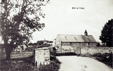
Mill of Udny
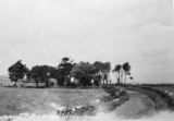
208 This postcard image, looking west, shows the Mill of Udny, located not far to the south east of Pitmedden, next to the Bronie Burn. This photograph likely dates from the early 20th century.
The large building shown here, which old OS maps indicate was a corn mill, is still there at the time of writing in 2022. As is the bridge over the Bronie Burn, though its walls appear to have been lowered.
The Mill of Udny is located on a small road, running east to west, between Housieside and Udny Green. The original buildings have been added to and it is now the site of the Mill Business Centre. Aberdeenshire: Donside and Strathbogie, an Illustrated Architectural Guide (2006) by Ian Shepherd indicates that this conversion took place in 1991.
A waterwheel can be seen on the southern side of the mill in this image. Early 20th century OS maps indicate this was powered by a lade, diverted from the Bronie Burn, that ran through the field to the west. A mill dam was once located to the south west across the field.
This image features in the book Old Udny, Tarves and Methlick (2007) by Donna M. Donald. In accompanying information the author states that in 1800 the mill was one of ten working in the Udny area. Donald also states that the mill was built in the middle of the 18th century, "by a forward-thinking laird", and remained in operation until the 1920s. Haymaking at Culter
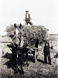
1023 This photograph from the early 1900's shows a pair of farm workers loading a cart with hay. After the hay was cut it would be forked into haycocks in the fields, hopefully drying in the sun and wind. It would be turned regularly to ensure it became fairly dry or 'wun'. The man on top of the cart receives forkfuls of hay lifted up to him by the other men, and it was his job to arrange it so that it lay neatly and didn't unbalance and fall off as the cart travelled back to the farm. Once there loads of hay would be built into hayricks, thatched to ensure that rain didn't soak inside. Horsemen at a farm at Hirn, Banchory
1026 Since farmwork was entirely dependent on horses and horsemen a great deal of pride was taken in them. It was common in the early 1900's for itinerant photographers to travel around to take photos of the farm workers. Here we see three horsemen with their pairs of Clydesdales. Farmworkers had a strict division of labour so that cattlemen did not work with horses and vice versa. Horsemen had their own hierarchy - the most experienced man would be first horseman and the other took their place down to the youngest and least experienced. The first horseman would lead out to the fields and the others followed in order and they would work the fields in the same manner. Even when all the workers were hoeing fields horseman would outrank cattlemen. Westerton of Auchmill Farm
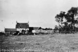
1472 This photograph, likely by James G. Kellas and taken in around 1951, looks north west towards the farm of Westerton of Auchmill.
Its buildings are located just north east of the Northfield housing estate and remain at this location as of 2020. They are now largely bordered by Auchmill Golf Course, which also covers the previously nearby Dancing Cairns Quarry.
While the farm buildings still exist, this lane, which in the opposite direction would have lead to Westerton/Midtown Farm, has been replaced by the housing around Bonnyview Drive. Westerton Farm
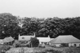
1474 A photograph, likely by James G. Kellas and from around 1951, showing one of either two farms known as Westerton. Both have since been demolished.
It could be the Westerton Farm that was located on the old road that preceded Provost Fraser Drive. Near where Provost Fraser Drive now meets Springhill Road, in the space between Provost Fraser and Springhill Terrace.
This Westerton Farm was demolished shortly after this photograph was taken to make way for the development of the Northfield housing estate.
Across the old road from this farm was the lands of Springhill House and Farm.
The other Westerton Farm was just to the north east of Northfield Farm and a bit south of Dancing Cairns Quarry. This farm was also previously known as Midtown.
Like Northfield Farm (demolished late 50s/early 60s), this Westerton survived the initial development of Northfield as a housing estate. Ordnance Survey maps suggest the farm made way for the construction of Marchburn Court, and the extension of Smithyhaugh Road, in the mid-to-late 1960s.
It is difficult to say for certain which farm this photograph shows. The hills in the background perhaps suggest we are looking west towards the more northernly Westerton, the one nearer Northfield Farm. West Summerfield Farm
1475 This image has not yet been indexed. Use the Comments button below the image to enter information about the photograph.
Please note: we will not include any personal information provided unless you indicate that you wish to be acknowledged. The standard form for crediting your information is (name, place) e.g. (John Smith, Aberdeen). Springhill Farm
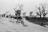
1476 A photograph of Springhill Farm. Looking north up Springhill Road. The building on the left can still been seen in 2017. The land around the farm and Springhill estate has been radically altered over the years. It is now flat parkland.
This photograph was likely taken by James G. Kellas in around 1951. Westerton and Caiesdykes Farm
1478 This image has not yet been indexed. Use the Comments button below the image to enter information about the photograph.
Please note: we will not include any personal information provided unless you indicate that you wish to be acknowledged. The standard form for crediting your information is (name, place) e.g. (John Smith, Aberdeen). Willowpark Croft farm
1479 This image has not yet been indexed. Use the Comments button below the image to enter information about the photograph.
Please note: we will not include any personal information provided unless you indicate that you wish to be acknowledged. The standard form for crediting your information is (name, place) e.g. (John Smith, Aberdeen). Raeden Farm
1480 This image has not yet been indexed. Use the Comments button below the image to enter information about the photograph.
Please note: we will not include any personal information provided unless you indicate that you wish to be acknowledged. The standard form for crediting your information is (name, place) e.g. (John Smith, Aberdeen). Old Town Farm
1481 This image has not yet been indexed. Use the Comments button below the image to enter information about the photograph.
Please note: we will not include any personal information provided unless you indicate that you wish to be acknowledged. The standard form for crediting your information is (name, place) e.g. (John Smith, Aberdeen). Silverhillock Farm
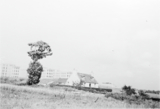
1482 An image looking north east showing Silverhillock Farm in the 1950s.
The property, through which flowed the Gilcomston Burn, was located at the junction of Westburn Road and Foresterhill Road.
The Royal Infirmary buildings can be seen in the background. Mains of Ruthrieston
1483 This photograph by James Kellas from the early 1950s shows a farm called Mains of Ruthrieston. It was located where Cranford Road joins Broomhill Road. This image looks north east from Cranford Road.
(Thanks to A. G. Duthie for identifying this location). Denhead Farm, Rubislaw
1484 This photograph by James Kellas from the early 1950s shows Denhead Farm in the area of Rubislaw. It was located on the south side of Carnegie Crescent, north of the western part of Rubislaw Den.
Local historian A. G. Duthie has been in touch to tell us that the Duncan family, who were tenants there, ran the farm as one of many market gardens in the Rubislaw Den area. It was a working farm until the later 1950s when it was demolished as part of residential development. Rosehill Farm
1485 A photograph, likely by James G. Kellas and from the early 1950s, showing Rosehill Hill Farm.
The large scale Ordnance Survey map surveyed in 1867, those revised in 1899 and in 1924 show the farm located on the north side of Cairncry Road. Rosehill Quarries were located to the north of the farm buildings.
The OS map surveyed in 1955 shows the farm surrounded by a modern housing estate. The buildings are then nos. 8, 10 and 12 Blackthorn Crescent.
The farm buildings later appear to have made way for new housing developments on Blackthorn Crescent and no remains of the farm can be seen today.
In the early 19th century the lands of Rosehill, along with Burnside and Ruthrieston, were acquired by Alexander Duthie, a successful advocate in Aberdeen, and later passed to his grandson Walter, a writer to the signet in Edinburgh. Walter was the uncle of Elizabeth Crombie Duthie, who donated Duthie Park to the people. See the latter's obituary in the Evening Express of 30th March 1885, page 3, for further detail. Raeden Home Farm
1486 This image has not yet been indexed. Use the Comments button below the image to enter information about the photograph.
Please note: we will not include any personal information provided unless you indicate that you wish to be acknowledged. The standard form for crediting your information is (name, place) e.g. (John Smith, Aberdeen). Bucksburn Farm
1492 This image has not yet been indexed. Use the Comments button below the image to enter information about the photograph.
Please note: we will not include any personal information provided unless you indicate that you wish to be acknowledged. The standard form for crediting your information is (name, place) e.g. (John Smith, Aberdeen). Burnieboozle Croft and Farm
1493 This image taken in the early 1950s looks north along a small road, roughly located in line with present day Craigiebuckler Avenue, towards Burnieboozle Croft and Farm. The line of trees in the background mark the side of Hazledene Road. Along this track in the opposite direction is the location of Burnieboolze House.
(Many thanks to A. G. Duthie for identifying this location). Burnieboozle Farm
1494 This photograph, likely dating from the early 1950s, looks north east and shows the yard of Burnieboozle Farm. It was located at the junction of Hazledene Road and what is now Craigiebuckler Avenue.
(Many thanks to A. G. Duthie for identifying this location). |


